This article has been reviewed according to Science X's editorial process and policies. Editors have highlighted the following attributes while ensuring the content's credibility:
fact-checked
peer-reviewed publication
trusted source
proofread
Making Arctic field geology accessible by digitizing outcrops

The Svalbox Digital Model Database (DMDb) just made its formal debut into the scientific community in a new article published in the journal Geosphere.
The Svalbard archipelago, located north of Norway halfway to the North Pole and well within the Arctic Circle, is a remote geological wonderland. Svalbox DMDb is a new regional database which currently collates 135 digital outcrop models (DOMs), making data from 114 km2 of this incredibly difficult-to-access area freely available to anyone with internet access.
Digital outcrop models are georeferenced three-dimensional digital representations of geologic outcrops that have revolutionized the way twenty-first century geoscientists work. In the Svalbox DMDb, these models are integrated with other geoscientific data. 3D drone footage is also available.
"It is like Google Street View…minus the street part," explains first author Peter Betlem. While DOMs are routinely used in research, education, and industry, they are often only available in their stand-alone, fully processed form.
What is unique about the Svalbox DMDb is that it is composed of data and metadata shared according to FAIR (i.e., findable, accessible, interoperable, and reusable) principles. Each database entry includes raw input and processed output data and has a DOI so that it is traceable and citable.

While working in Svalbard, Betlem quickly realized that the amount of drone data collected in a single field campaign is enormous and only grows with every step of processing. Having a good digital infrastructure to archive the data was critical to his success. "These were the early days of DOMs, and there was a lot to figure out," recalls Betlem. It took many years and several iterations to get to the current form of the Svalbox DMDb.
Today, the Svalbox DMDb provides a unique resource for all geoscientists working in the archipelago, as well as a great teaching aid. Its digital outcrop models complement traditional field work by extending the field season indefinitely and expanding scientists' reach to sites that are not accessible through traditional field work, as well as allowing them to better prepare for upcoming expeditions.
"Not knowing what a field site looks like can really hold you back," clarifies Betlem, "especially in the Arctic, where the landscape changes rapidly as glaciers recede." These changes can now be preserved in time-lapse through the Svalbox DMDb, their geological potential thus safeguarded for generations to come. "In the months leading up to field season we get a couple of inquiries per week on the datasets: do you have more? Can we use them?" This has already led to collaborations and publications, two fundamental pillars of scientific research.
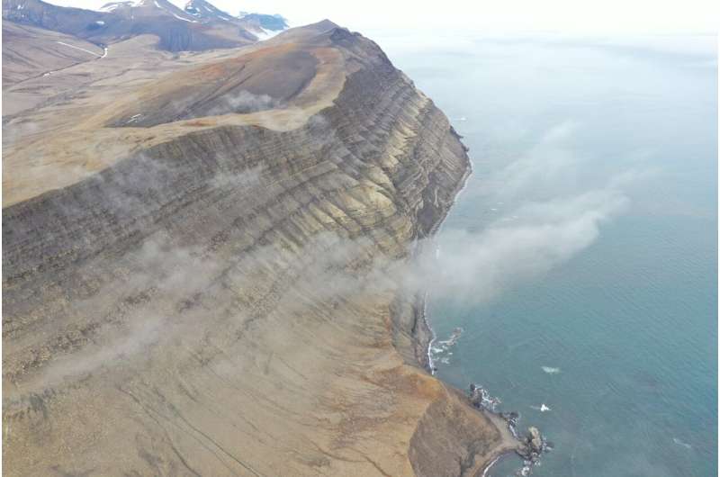
The Svalbard archipelago offers an incredible variety of quality outcrops spanning a wide range of lithologies and tectono-magmatic styles. A personal favorite of Betlem's, detailed in the Geosphere paper, is the Festningen profile, Svalbard's only geotope. This outcrop spans 400 million years across a 7 km transect with vertical stratigraphy. "You literally walk back in time, starting in the Paleogene and crossing the Permian-Triassic boundary before reaching Carboniferous sequences," says Betlem.
Sometimes data acquisition is drone-based; sometimes it is handheld. Precisely constraining the GPS location of each individual image is fundamental to extracting key geological measurements such as strike and dip a posteriori. All images get oriented and merged through photogrammetry, the science of extracting 3D information from photographs.
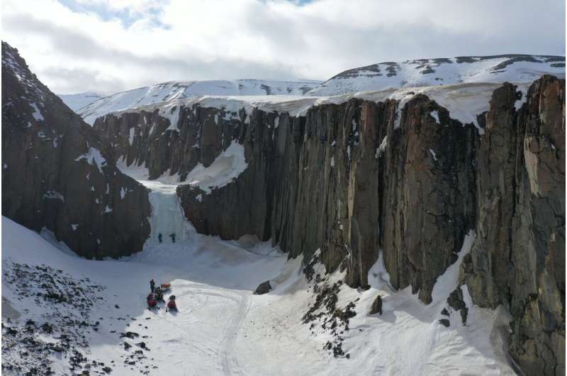
But it is getting to the outcrop to be digitized that is a real adventure. Any means of transportation is fair game, from boats to snowmobiles. The field season is restricted to about 100 days per year in late spring and summer, squished in between the long polar night that extends from October to February.
Svalbox DMDb is constantly expanding with the addition of more DOMs. Betlem is currently gearing up for his next field season, and as he heads up to 80ºN with the Svalbox team they will collect additional drone footage of hot springs and other volcanic remnants. Visit https://www.svalbox.no/map to see it come to digital life.
More information: Peter Betlem et al, Svalbox Digital Model Database: A geoscientific window into the High Arctic, Geosphere (2023). DOI: 10.1130/GES02606.1
Journal information: GeoSphere
Provided by Geological Society of America


